

Want to share this event? Copy and share this website link
Join us for the greatest walk of all
You might be interested in...

Registration information
Find out how to register, ticket prices and how to create or join a team.

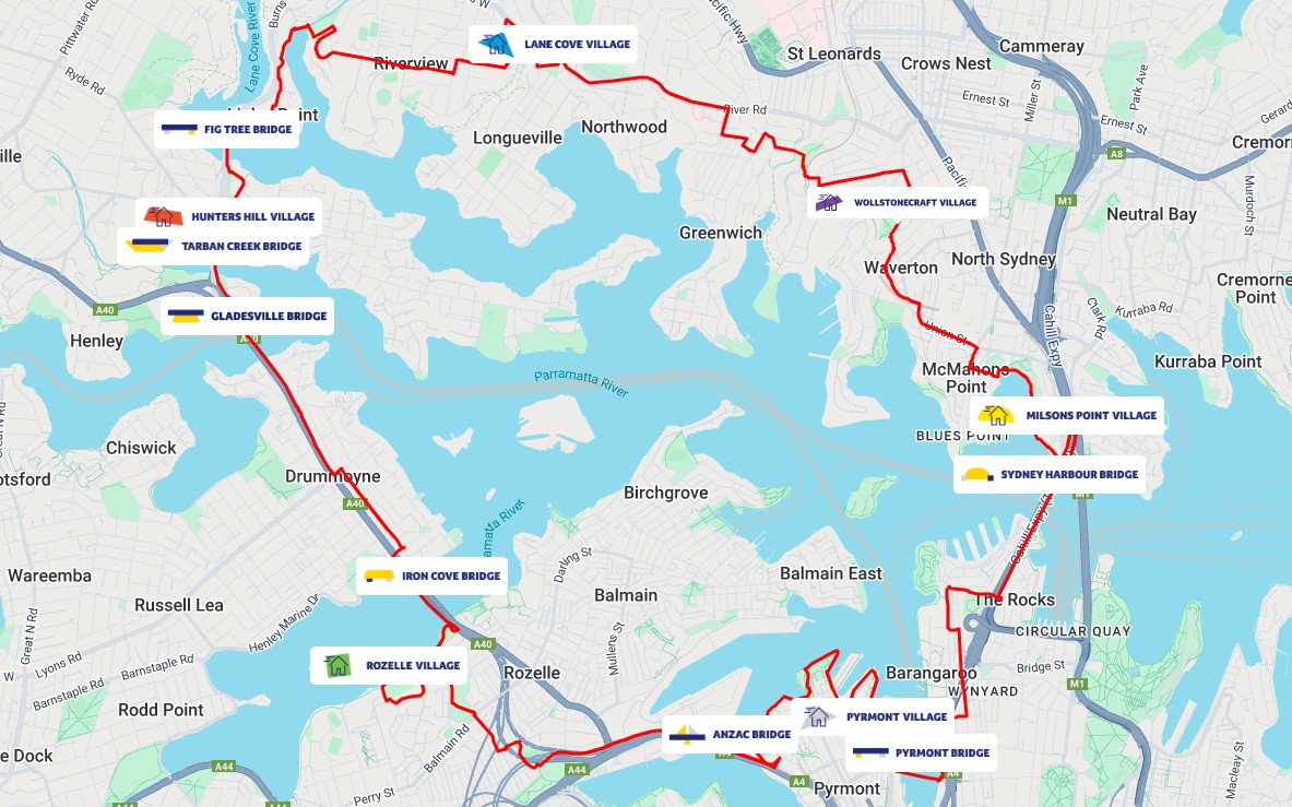
Plan your day
See the course information, food and entertainment, free buses and accessibility.


